// CATEGORY
viewpoint
121 destinations.
viewpoint · vermont
Appalachian Gap Summit — VT-17
The Appalachian Gap ("App Gap") is the highest paved mountain pass road in Vermont, cresting at 2,369 feet on Route 17 in Buels Gore. The summit parking area sits just west of the crest and gives immediate access to sweeping views of the Champlain Valley, Lake Champlain, and the Adirondack Mountains of New York on clear days. The Long Trail crosses here, and a short walk north or south yields even wider panoramas. The eastern approach from Waitsfield climbs through dense hardwood forest with sustained 15% grades and tight switchbacks — generally considered one of the finest motorcycle roads in the state. Open seasonally; check conditions in shoulder season.
viewpoint · florida
Bahia Honda State Park — Old Bridge Overlook
Bahia Honda State Park at 36850 Overseas Highway (MM 37, Big Pine Key) contains the remnant of Henry Flagler's 1912 Overseas Railroad bridge — a 5,055-foot structure that was hailed as an engineering marvel of the Western Hemisphere. A trail leads from the park up onto the elevated deck of the old bridge, providing a panoramic 360-degree view of the Atlantic Ocean, the Gulf of Mexico, and the chain of keys stretching in both directions. The park also has three distinct beaches rated among the best in Florida. Entry fee is required ($8 per vehicle). The old bridge reopened for pedestrian and cyclist access following restoration work.
viewpoint · utah
Bald Mountain Pass Overlook — Mirror Lake Hwy
Highest paved point on the Mirror Lake Highway (UT-150) at 10,715 ft, roughly 30 miles from Kamas. The designated pull-off has parking for ~25 vehicles, picnic tables, and vault toilets. Views extend south over the route you rode and north-east toward Hayden Peak and the High Uintas Wilderness.
viewpoint · pennsylvania
Baughman Rock Overlook
A dramatic cliff-top overlook inside Ohiopyle State Park in the Laurel Highlands, reached via a 75-yard walk from a large gravel parking area on Sugarloaf Road off Route 381. From the top of Baughman Rock — a massive sandstone outcropping on Laurel Ridge — the view sweeps across the Youghiogheny River Gorge below, one of the finest vistas in southwestern Pennsylvania. Route 381 and the surrounding Laurel Highlands roads offer tight elevation changes and empty two-lane tarmac that rival any riding in the state.
viewpoint · wyoming
Beartooth Lake Viewpoint
An alpine lake sitting at 9,000 ft in Shoshone National Forest on the Wyoming side of US-212. A short roadside pull-out offers views of the lake nestled between rugged mountain slopes — one of the most accessible and photogenic stops on the Wyoming portion of the Beartooth Highway before the route climbs toward the Montana state line.

viewpoint · rhode island
Beavertail State Park
The southernmost tip of Conanicut Island in Jamestown, featuring the 1856 Beavertail Lighthouse and dramatic open-ocean cliff-side overlooks. Four formal viewpoints plus miles of walkable rocky coastline give riders a genuine Atlantic headland experience. The short Beavertail Road from Jamestown village is a sweeping, low-traffic run through coastal farmland to the cliffs.
viewpoint · alaska
Beluga Point Overlook
Roadside pull-off at Mile 110.5 of the Seward Highway with 180-degree views over Turnagain Arm. Spotting scopes and interpretive signs on-site; prime spot to watch the bore tide surge and, in mid-July through August, beluga whales. One of the most-photographed stops on Alaska's most scenic highway.
viewpoint · missouri
Big Spring
One of the largest springs in the United States, Big Spring discharges an average of 286 million gallons of water per day from the base of a 140-foot dolomite bluff on the Current River, 4 miles south of Van Buren off MO-103. Managed by the National Park Service as part of the Ozark National Scenic Riverways, the site has a paved parking area, a short trail to the spring pool, and a historic CCC-era picnic shelter. Riders on MO-103 or the Ozark Hellbender route (MO-19 corridor) routinely detour here; the blue-green water emerging from solid rock is a striking visual reward.
viewpoint · california
Bixby Creek Bridge Overlook
Bixby Creek Bridge on Highway 1 is one of the most photographed concrete arch bridges in the world, spanning a dramatic coastal canyon 13 miles south of Carmel. The north-side turnout offers the iconic view of the bridge with Pacific cliffs and ocean beyond. Built in 1932, the single-span arch rises 280 feet above the creek. For motorcyclists riding the Pacific Coast Highway through Big Sur, this is the defining photo stop — the curves of Highway 1 approaching from both directions are themselves a highlight. Park in the turnout on the north side of the bridge; do not stop on the bridge itself.
viewpoint · georgia
Brasstown Bald Visitor Center
Georgia's highest point at 4,784 feet, accessed via a scenic spur off GA-180. Riders park at the lot 0.5 miles below the summit and either hike or take the shuttle to the observation deck, which offers a 360-degree view across four states. The USFS Visitor Center houses exhibits on the Southern Appalachian ecosystem. The approach road (GA-180 Spur) adds a bonus set of tight curves on top of an already excellent ride.
viewpoint · kentucky
Breaks Interstate Park Overlook
Breaks Interstate Park straddles the Kentucky–Virginia line 7 miles east of Elkhorn City, KY, protecting the deepest gorge east of the Mississippi River — five miles long and up to 1,600 feet deep, carved by the Russell Fork of the Big Sandy. Four named overlooks (Clinchfield, Stateline, Grassy, and the Geological Trail viewpoint) look down into the canyon. The park entrance is reached via KY-80/VA-80, a sinuous mountain road that is itself a destination. A $3 day-use fee applies; the Visitor Center has maps, restrooms, and a historical museum.
viewpoint · rhode island
Brenton Point State Park
The southwesternmost tip of Aquidneck Island where Ocean Drive bends hard at the Atlantic. An 89-acre former estate with open grassy headlands, rocky shoreline, and sweeping views of Block Island Sound and passing sailboats. The classic turnaround on the 10-mile Ocean Drive loop — riders pull off on the wide shoulder to take in the view before heading back up the coast.
viewpoint · south dakota
Bridal Veil Falls Pullout
A 60-foot waterfall cascading down a sheer limestone cliff directly beside US-14A (Spearfish Canyon Scenic Byway), roughly 5.8 miles south of the canyon's north entrance. A paved crosswalk leads to a wooden viewing platform on the opposite bank — one of the easiest waterfall stops in the Black Hills, with roadside parking on the shoulders.
viewpoint · michigan
Brockway Mountain Drive Overlook
The lookout at the top of the 9-mile Brockway Mountain Drive off M-26 — 735 feet above Lake Superior with 360° views (Isle Royale on a clear day), billed as the highest drive between the Rockies and the Alleghenies.
viewpoint · michigan
Brockway Mountain Drive Summit
The 9-mile Brockway Mountain Drive climbs to 1,320 feet above sea level — 720 feet above Lake Superior — making it the highest paved road between the Rockies and the Alleghenies. The summit overlook delivers a 360-degree panorama: Copper Harbor below, the Keweenaw wilderness stretching south, Lake Superior to the north, and Isle Royale visible on clear days roughly 50 miles offshore. The two-lane road is entirely rideable, connecting M-26 between Eagle Harbor and Copper Harbor. Spring hawk migrations are visible from the overlook in May. The road is seasonal (typically May through November) and maintained by Keweenaw County.
viewpoint · indiana
Brown County State Park North Gate Overlook
Brown County State Park encompasses 16,000 acres of rugged hills, ridges, and ravines in south-central Indiana — the largest state park in Indiana. The North Gate entrance at 1801 State Road 46 E gives access to nearly 20 miles of tree-lined park roads with multiple scenic vistas overlooking miles of uninterrupted forestland. The park is a natural extension of the SR-46 motorcycle corridor from Bloomington, and the forest roads inside provide additional low-speed winding miles beyond the main byway.
viewpoint · wisconsin
Buena Vista Overlook
Buena Vista Park sits 500 feet above the Mississippi River in Alma, WI, reached by a short paved walk from the Buena Vista Road parking area off County Road E. From the rock outcropping, views extend miles north across Pool 4 and Lake Pepin and south through the bottomland floodplain. Better Homes & Gardens named it one of the river valley's finest natural balconies. The park includes a picnic shelter, tables, and vault toilets. Free access, open daily 8 a.m.–11 p.m. It sits directly on the Great River Road (WI-35), making it a natural mid-ride stop for anyone running the 250-mile byway.
viewpoint · new hampshire
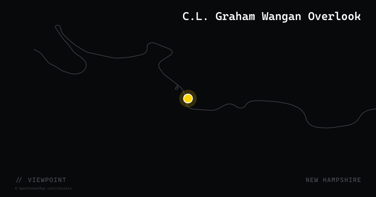
C.L. Graham Wangan Overlook
A Forest Service–maintained roadside overlook on the eastern stretch of the Kancamagus Highway (NH-112) in Bartlett, just beyond Kancamagus Pass at roughly mile 20 from the Conway side. The overlook provides wide views of the Swift River Watershed and the mountains to the north and east, with a generous paved parking area that accommodates large groups of motorcycles. Maintained restrooms are available at the site. The overlook is one of the most visited scenic stops on the Kanc and is especially popular during fall foliage season.
viewpoint · maine
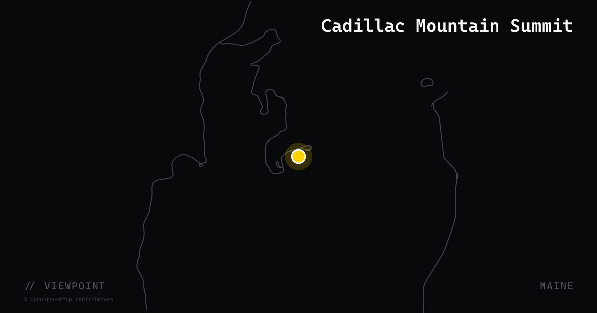
Cadillac Mountain Summit
At 1,530 feet, Cadillac Mountain is the highest point on the U.S. Atlantic coast north of Rio de Janeiro and the first place in the contiguous United States to see the sunrise for part of the year. A 3.5-mile paved summit road branches off the Park Loop Road inside Acadia National Park, spiraling to a summit with 360-degree views of Frenchman Bay, the Porcupine Islands, and the full Mount Desert Island ridge. The summit has a parking area, gift shop, and restrooms. A timed vehicle reservation is required from late May through mid-October — motorcycles must reserve individually. Closed November through April.
viewpoint · south carolina
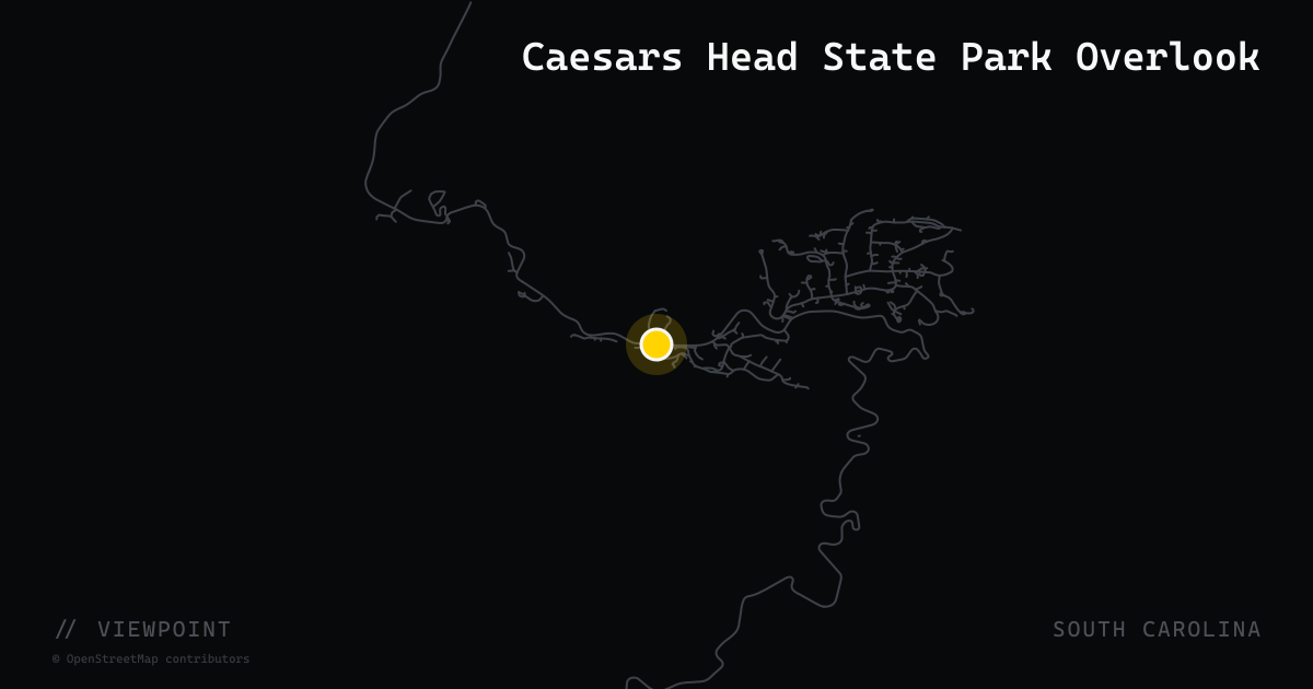
Caesars Head State Park Overlook
Atop the Blue Ridge Escarpment at 3,200 feet, the Caesars Head State Park overlook delivers one of the widest panoramas in the Upstate — sweeping views extend into North Carolina and Georgia on clear days, taking in Table Rock, Sassafras Mountain, and the Dismal Forest. The rocky granitic-gneiss outcrop that gives the park its name is a two-minute walk from the visitor center parking lot on US-276 (Geer Highway). The overlook is also the premier raptor-watching perch in the region: thousands of hawks, eagles, and vultures funnel past the escarpment edge each fall (September–November). The visitor center has trail maps, a small gift shop, and restrooms. Park hours are 9 a.m. to sunset; admission is charged per vehicle.

viewpoint · tennessee
Calderwood Dam Overlook
The Calderwood Dam Overlook is a pull-off on US-129 in Tallassee, Tennessee, positioned at the northern (Tennessee) end of the Tail of the Dragon. From the overlook, riders look south into the gorge of the Little Tennessee River at the circa-1930 Calderwood hydroelectric dam and reservoir, backed by ridges of the Great Smoky Mountains. It is a common regrouping point where riders finishing the Dragon's 318-curve, 11-mile stretch pull over to share accounts of the run or turn around for another pass.
viewpoint · nevada
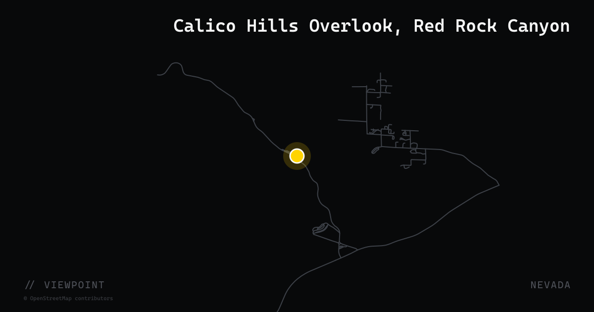
Calico Hills Overlook, Red Rock Canyon
The Calico Hills pullouts (Calico I and Calico II) are the first major scenic stops on Red Rock Canyon National Conservation Area's 13-mile one-way Scenic Loop Drive, located 17 miles west of the Las Vegas Strip on SR-159. Vivid bands of red, orange, and cream Aztec sandstone rise hundreds of feet above the desert floor, and the overlooks provide unobstructed views across the geological formations that give Red Rock its name. Restrooms are available at Calico II. The Scenic Loop is a timed-entry drive (reservation required in peak season) that routinely ranks among the top short rides near Las Vegas.
viewpoint · utah
Canyon Overlook Trail — Zion-Mt. Carmel Hwy
The most accessible high viewpoint on the Zion-Mt. Carmel Highway (UT-9). The trailhead sits immediately east of the 1.1-mile Zion-Mt. Carmel Tunnel; the half-mile paved path ends on a sandstone ledge with an unobstructed western view across Zion Canyon and the Towers of the Virgin. No fee to park at the roadside lot (Zion entrance fee still applies).
viewpoint · west virginia
Canyon Rim Visitor Center
The NPS Canyon Rim Visitor Center (162 Visitor Center Rd, Lansing) is the premier above-deck vantage point for the New River Gorge Bridge — the longest single-arch steel bridge in the Western Hemisphere at 3,030 ft and 876 ft above the river. Two overlook tiers: a panoramic upper platform and an arch-level lower boardwalk. The visitor center has ranger exhibits, restrooms, and a bookshop. Open 9 am–5 pm. Bridge Day, held every third Saturday in October, draws 100,000+ visitors including a huge motorcycle contingent.
viewpoint · delaware
Cape Henlopen State Park — The Point
The tip of the sandy peninsula where the Delaware Bay meets the Atlantic Ocean. Riders enter via Lewes on Cape Henlopen Drive and park near the beach access; the overlook delivers panoramic water views and, in winter, access to the hiking spit itself. WWII fire-control towers are also visible on the way in.
viewpoint · rhode island
Castle Hill Lighthouse
A stubby 1890 granite lighthouse perched on the rocky Castle Hill headland where Narragansett Bay meets the Atlantic. Accessible via a short walk off Ocean Drive, it marks the western entrance to Newport Harbor and offers panoramic water views in three directions. The surrounding grounds of Castle Hill Inn are open to visitors on foot.
viewpoint · ohio
Cedar Falls — Hocking Hills State Park
Cedar Falls is the highest-volume waterfall in Hocking Hills State Park, reached from the parking area off SR-374 at 21190 OH-374 in Logan. The half-mile trail descends through hemlock-shaded hollows to a plunge pool below 50-foot sandstone walls. The waterfall runs year-round and is the visual centrepiece of the SR-374/664 Hocking Hills Scenic Byway — the same road that delivers the region's best motorcycle curves. A picnic area and restrooms sit in the parking lot. No fee to park or hike. The park entrance is roughly equidistant from SR-374 (Rockbridge) and SR-56 (South Bloomingville), placing it midpoint on the classic Hocking Hills loop ride.
viewpoint · alabama
Cheaha Summit / Bald Rock Overlook
Alabama's highest point at 2,407 ft offers panoramic views of Talladega National Forest from the Bald Rock boardwalk — a natural summit stop at the top of the Talladega Scenic Drive and AL-281.
viewpoint · oregon
Cloudcap Overlook
Cloudcap Overlook is the highest point in Crater Lake National Park accessible to motor vehicles, sitting on the eastern rim at approximately 7,960 feet. The paved pull-off provides an elevated, unobstructed view across the deep-blue caldera to Wizard Island and the western ridgeline. It is reached via Rim Drive, the 33-mile loop road that encircles the lake, and sits roughly 17 miles northeast of Rim Village. The overlook is open only when Rim Drive is clear of snow — typically mid-July through October. Motorcycles pay a separate entry fee at park gates.
viewpoint · virginia
Crescent Rock Overlook
At Skyline Drive milepost 44.4 and 3,550 ft elevation, Crescent Rock Overlook faces west over the Shenandoah Valley with an unobstructed view of Hawksbill Peak — the park's highest summit at 4,050 ft. The pull-off is large and tiered, comfortable even on busy fall weekends, and a short 0.9-mile trail leads to the rock formation itself.
viewpoint · utah
Dead Horse Point State Park Overlook
Utah State Park perched 2,000 feet above the Colorado River and Canyonlands National Park, 32 miles from Moab via UT-313. The main overlook is vehicle-accessible with a paved ADA path and a broad view into the canyon meanders. Day-use fee required. Seven overlooks total accessible by rim trail.
viewpoint · alabama
DeSoto Falls Overlook
A 107-foot waterfall inside DeSoto State Park, reached via a paved pathway off Lookout Mountain Parkway. One of Alabama's tallest and most visited falls, with a railed overlook platform and a restaurant nearby.

viewpoint · texas
Devil's Backbone Overlook
A signed roadside rest area at approximately 5299 FM 32 in the Comal County hill country, north of Canyon Lake. The overlook sits atop the narrow limestone ridge known as the Devil's Backbone, offering sweeping panoramic views of the Texas Hill Country — rolling oak and juniper-covered valleys extending in every direction. A small paved pullout and picnic tables allow riders to stop safely. FM 32 itself is one of the premier motorcycle roads in the Hill Country, with technical curves, elevation changes, and minimal traffic between Wimberley and Medina.
viewpoint · oregon
Devil's Churn
Devil's Churn is a narrow basalt sea channel at Cape Perpetua, carved by centuries of Pacific wave action into the rocky coastline along US-101 south of Yachats. At high tide or in swell, ocean waves surge into the slot and explode upward, creating a dramatic churn visible from the paved overlook directly off the highway. The site is managed by the Siuslaw National Forest; a Northwest Forest Pass or America the Beautiful pass is required. The restless-waters viewpoint parking area is on the west side of US-101 at 2400 US-101, approximately 2.5 miles south of Yachats.
viewpoint · washington
Diablo Lake Overlook
Diablo Lake Overlook is located at milepost 131.7 on SR-20 in North Cascades National Park. A large paved parking area with accessible vault toilets and picnic tables perches directly above the reservoir, whose water turns an otherworldly turquoise in summer due to suspended glacial flour. Below the overlook the historic Diablo Dam is visible in the distance, framed by the massive ridgelines of the North Cascades. The turquoise color is most vivid on sunny days in July, August, and September when seasonal glacial melt peaks. Riders on SR-20 pass this spot without even having to detour — the pullout is right on the highway.

viewpoint · california
Donnell Vista
Donnell Vista is a USDA Forest Service scenic overlook on Highway 108 (Sonora Pass Road), approximately 18 miles east of Pinecrest in Stanislaus National Forest. A quarter-mile paved accessible trail leads from the roadside pullout to a dramatic cliff-edge viewpoint perched above the Middle Fork Stanislaus River Canyon and Donnell Reservoir, with the volcanic Dardanelles formation rising beyond. Elevation at the overlook is approximately 6,300 feet. The panoramic views of the granite and volcanic canyon are among the most striking anywhere on the Sonora Pass corridor, a top-10 motorcycle road in California.
viewpoint · idaho
Galena Summit Overlook
Also called the Bethine and Frank Church Overlook, this roadside pullout on ID-75 sits at 8,701 ft at the high point of the Sawtooth Scenic Byway. A viewing platform with interpretive plaques delivers panoramic vistas of the jagged Sawtooth Range and the broad Sawtooth Valley below, including the headwaters of the Salmon River. Rated difficulty 1 (easy access) by the Idaho Adventure Motorcycle Club.
viewpoint · florida
Gamble Rogers Memorial State Recreation Area
Gamble Rogers Memorial State Recreation Area at 3100 S. Oceanshore Boulevard (A1A) in Flagler Beach marks the southern terminus of the A1A Scenic and Historic Coastal Byway, one of only two roads in Florida designated an All-American Road by the Federal Highway Administration. The park sits directly between the Atlantic Ocean and the Intracoastal Waterway, with pull-outs offering unobstructed ocean views. Named for folk singer and Florida resident Gamble Rogers, who died rescuing a swimmer in 1991. Popular beach access and restroom facilities make it a natural break point on an A1A ride.
viewpoint · illinois
Garden of the Gods Recreation Area
A National Forest Service site in the Shawnee National Forest near Herod, IL, where 300-million-year-old sandstone formations rise above the forest canopy. The 0.25-mile observation trail leads to a ridgeline overlook with long views over the forested hills of southern Illinois — the most-visited overlook in the Shawnee. Parking, vault toilets, and picnic tables are on site at 1 Picnic Rd, Herod, IL 62947. The wilderness boundary prohibits motorcycles on trails, but the roads in and around the recreation area are open and accessible.
viewpoint · montana
Georgetown Lake Overlook
Scenic pull-out on Montana Highway 1 (Pintler Veterans' Memorial Scenic Highway) overlooking Georgetown Lake at 6,425 ft, with the Pintler Range as a backdrop. The 3,700-acre reservoir sits in a glacially carved valley and marks the high point of the MT-1 run between Anaconda and Drummond.
viewpoint · missouri
Glade Top Trail — Arkansas View Overlook
The Arkansas View Overlook is Stop 3 on the Glade Top National Forest Scenic Byway (FS-147), Missouri's only National Forest Scenic Byway. The 23-mile gravel-surface ridge road was built by the Civilian Conservation Corps in the late 1930s and follows narrow ridge tops 500 feet above the surrounding landscape. The Arkansas View pull-off looks south 40 miles to the Boston Mountains in Arkansas — one of seven named overlooks on the trail. The byway runs between Ava and Longrun in the Mark Twain National Forest and borders the Hercules Glades Wilderness Area.
viewpoint · oklahoma
Gloss Mountain State Park (Cathedral Mountain)
Cathedral Mountain at Gloss Mountain State Park in Major County rises 150–200 feet above the surrounding prairie on US-412 between Fairview and Enid. The selenite-capped mesas that give the Glass/Gloss Mountains their name flash silver in direct sun. A short staircase trail (1.2 miles round-trip) climbs Cathedral Mountain for a panoramic view over Lone Peak Mountain and the flat wheat country of northwest Oklahoma. Free access, year-round. The park's roadside pull-out makes it a quick spontaneous stop mid-ride.
viewpoint · kansas
Gypsum Hills Scenic Byway Overlook Corridor
The Gypsum Hills Scenic Byway runs 42 miles on US-160 west from Medicine Lodge to Coldwater through Barber County's Red Hills — iron-rich rust-colored mesas, cedar-studded canyons, and open buttes that are visually unlike anywhere else in Kansas. The landscape is sometimes called the 'Little Grand Canyon of Kansas.' Wildlife sightings (pheasant, deer, wild turkey) are common along the two-lane corridor. Voted one of the 8 Wonders of Kansas by the Kansas Sampler Foundation. Medicine Lodge itself has the Stockade Museum and the Carry A. Nation Home for a quick cultural stop before or after the ride.
viewpoint · massachusetts
Hairpin Turn Overlook
The most famous single corner in Massachusetts motorcycling: a sharp hairpin on Route 2 (Mohawk Trail) at 1,700 feet elevation where the road drops 700 feet in roughly two miles. The pull-off beside the Golden Eagle Restaurant frames a 90-mile panorama of the Hoosac Valley, Mount Greylock, Mount Prospect, and slivers of Vermont. The Golden Eagle has operated continuously since 1914, making it the oldest roadside restaurant on the Mohawk Trail. The hairpin sits on the boundary of North Adams and Clarksburg.
viewpoint · new hampshire
Hancock Overlook — Kancamagus Highway
Situated at mile 23.8 on the Kancamagus Highway (NH-112) near Lincoln, the Hancock Overlook delivers a sweeping southward view of the Osceola Mountains and the Pemigewasset Wilderness from an elevation of roughly 2,150 feet. A paved pull-off with space for several vehicles sits just past the notorious hairpin turn on the Lincoln side of Kancamagus Pass — riders who have just navigated the hairpin arrive at the overlook with adrenaline and a panoramic reward. The fall foliage views from this spot are among the most photographed in New Hampshire.
viewpoint · west virginia
Hawks Nest State Park Overlook
Built by the CCC in the mid-1930s from local sandstone, the Hawks Nest clifftop overlook sits directly on US-60 in Ansted and delivers a 750-foot vertical drop to the New River below. The horseshoe-shaped paved walkway is 80 yards with a handicap-accessible viewing station aimed at the dam and the New River's dry gorge. The park lodge, aerial tramway to the gorge floor, and small gift shop are all steps away. Easy roadside pull-off with no hiking required.
viewpoint · connecticut
Haystack Mountain Tower
A 34-foot stone observation tower crowning 1,680-foot Haystack Mountain in Haystack Mountain State Park, Norfolk. Built in 1929 and donated to the state, the tower yields three-state views and a glimpse of Long Island Sound on clear days. A 1.3-mile paved access road off Route 272 leads to a small summit parking lot, making it reachable by any bike without hiking.
viewpoint · maine
Height of Land
Perched beside Route 17 in Township D, about 25 minutes south of Rangeley, Height of Land is one of the most celebrated roadside overlooks in the Northeast. The pull-off delivers a sweeping panorama of Mooselookmeguntic Lake and the full Rangeley Lakes basin, framed by rolling forested ridgelines stretching to the horizon. A paved parking area accommodates motorcycles easily, and the viewing platform is accessible from the road in under a minute. The vista rewards the winding climb up Route 17 from the south — motorcyclists routinely rate this stretch among the best riding in New England.
viewpoint · oregon
Hells Canyon Overlook
Hells Canyon Overlook is a paved, accessible viewpoint at 5,400 feet elevation on Forest Road 490 off the Hells Canyon Scenic Byway, offering outstanding panoramic views of Hells Canyon — the deepest river gorge in North America at over 7,900 feet — along with McGraw Creek and the Seven Devils Mountains of Idaho across the Snake River. Interpretive signs, vault toilets, and picnic tables are on site. The overlook is reached from Halfway or Joseph, Oregon, and is typically snow-free from late May through October. The approach road is paved to the overlook.
viewpoint · new jersey
High Point Monument Overlook
New Jersey's highest point at 1,804 ft, topped by a 220-ft war-memorial obelisk built in 1930. On a clear day the views span three states: ridges of the Poconos to the west, the Catskills to the north, and the Wallkill Valley to the southeast. Located inside High Point State Park off Route 23.
viewpoint · maryland
High Rock Overlook
A drive-to-the-top viewpoint on South Mountain at roughly 1,824 ft elevation, where the Appalachian Trail crosses a graffiti-covered rock ledge with a 180-degree panorama stretching north into Pennsylvania. The road off MD-491/Pen Mar High Rock Road takes riders right to the parking lot — no hiking required. It doubles as a hang-glider launch site. Free, open year-round, and notorious for its technicolor spray-paint rock canvas.
viewpoint · vermont
Hogback Mountain Scenic Overlook
Hogback Mountain Scenic Overlook sits directly beside Route 9 (the Molly Stark Scenic Byway) in Marlboro, roughly 14 miles west of Brattleboro. From an elevation of about 2,400 feet, the overlook delivers a 100-mile panorama spanning three states — southern Vermont's ridgelines, northern Massachusetts, and western New Hampshire. The Hogback Mountain Country Store and gift shop are located at the pull-off and provide parking, a small restroom, and seasonal food options. The viewpoint is accessible within a few steps from the parking area, making it a zero-effort destination on a fast-moving tour of the Molly Stark Trail.
viewpoint · georgia
Hogpen Gap Overlook
The highest point on the Richard B. Russell Scenic Highway (GA-348), where the Appalachian Trail crosses the road. A natural pull-off delivers long-range panoramic views of North Georgia's Blue Ridge ridgelines. The gap sits roughly midway along the 14-mile byway between Robertstown and Brasstown Valley, making it the signature photo stop on one of Georgia's premier motorcycle roads.
viewpoint · colorado
Independence Pass Summit
Independence Pass reaches 12,095 feet at the Continental Divide on Colorado SH-82 between Twin Lakes and Aspen — the second-highest paved pass in the state. A paved loop path at the summit leads to two overlooks with direct views of the Lake Creek valley and the surrounding Sawatch peaks, including Mount Elbert (14,439 ft), Colorado's highest summit. The road is closed to vehicles over 35 feet, meaning SH-82 is almost exclusively automobiles and motorcycles in season. The pass typically opens around Memorial Day and closes in late October, with 32 miles of twisting, high-altitude road on each side.
viewpoint · new york
Inspiration Point Overlook — Letchworth State Park
Inspiration Point Overlook is a roadside viewpoint on the main gorge drive inside Letchworth State Park, near Castile, NY 14427, often called the 'Grand Canyon of the East.' From this overlook, the Genesee River gorge drops 600 feet below, framing the Middle Falls (107 feet), Upper Falls (71 feet), and the historic Genesee Arch railroad bridge in a single view. The paved gorge road passes multiple pull-offs and is accessible by motorcycle via any of the park's four entrances. The park spans 14,350 acres in western New York.
viewpoint · south dakota
Iron Mountain Road Pigtail Bridges
Three corkscrew wooden bridges on US-16A that spiral over their own roadbed to gain elevation without blasting switchbacks into the hillside — a 1933 engineering feat designed by Peter Norbeck. Each of the three tunnels along the same stretch is deliberately aligned to frame Mount Rushmore in the exit portal. The north-end pullout at the bridge cluster is the prime stop on this 17-mile road of 314 curves and 14 switchbacks.
viewpoint · mississippi
Jeff Busby Site — Little Mountain Overlook
The only true overlook on the Mississippi section of the Natchez Trace Parkway, atop Little Mountain at milepost 193.1. A 0.8-mile trail climbs to 584 ft elevation; on a clear day the view stretches roughly 20 miles across the ridges and valleys of central Mississippi. NPS-managed with restrooms, picnic tables, and an 18-site campground.
viewpoint · nevada
Lamoille Canyon Road End Trailhead
The terminus of Lamoille Canyon Road (Forest Road 660 / NV-227 spur) sits at 8,800 feet in the Ruby Mountains of northeastern Nevada, 27 miles southeast of Elko. The U-shaped canyon was carved by Pleistocene glaciers into a dramatic alpine amphitheater with sheer granite walls rising over 3,000 feet. The large trailhead parking area at the road's end anchors the Ruby Mountains Scenic Byway and provides access to trails toward Island Lake and Lamoille Lake. The drive up the canyon — 12 miles of paved byway with no dead-end turnaround issue for bikes — is routinely ranked among Nevada's finest alpine roads.
viewpoint · utah
Larb Hollow Overlook
USDA Forest Service overlook on Scenic Byway 12 in Fishlake National Forest, roughly 15 miles southeast of Torrey. Panoramic views sweep across the Waterpocket Fold in Capitol Reef National Park and the Henry Mountains. Paved pull-in with vault toilets and picnic tables. Open May–September.
viewpoint · california
Leavitt Falls Vista Point
Leavitt Falls Vista Point is a pullout on Highway 108 (Sonora Pass Road) approximately 8.8 miles west of US-395 in Humboldt-Toiyabe National Forest, Mono County. A short walk from the turnout delivers views of Leavitt Falls cascading down granite slabs into Leavitt Meadow below, with broad panoramas of the West Walker River valley and the high Sierra above. The viewpoint sits on the eastern descent of Sonora Pass, where the highway opens into sweeping alpine terrain after the tight switchbacks at the summit. Open approximately late May through October depending on snowpack.
viewpoint · pennsylvania
Leonard Harrison State Park Overlook
The premier overlook of the Pennsylvania Grand Canyon (Pine Creek Gorge), a 47-mile-long, 1,000-foot-deep canyon carved through north-central PA. The east-rim overlook at 585-acre Leonard Harrison State Park sits at the end of Route 660 west of Wellsboro and looks directly into the gorge with a staffed visitor center, gift shop, picnic areas, and seasonal food truck. Pine Creek Gorge is one of the deepest canyons east of the Mississippi, and on autumn weekends the hardwood canopy creates a wall of color against the evergreens below. PA-44 and PA-144 — two of the best motorcycle roads in the state — converge on this area.
viewpoint · wyoming
Libby Flats Observation Site
The highest point on Wyoming Highway 130 (Snowy Range Scenic Byway) at 10,665 ft in Medicine Bow National Forest. A short walk from the parking area reaches the stone observation tower, which offers 360-degree views spanning Rocky Mountain National Park to the south, Medicine Bow Peak and Sierra Madre to the west, and the Laramie Mountains to the east. Open May through October.
viewpoint · alabama
Little River Falls Overlook
A short walk from AL-35 drops you to a railed overlook of Little River Falls — 45 ft of cascades marking the head of one of the deepest canyons east of the Mississippi. Free, NPS-managed, with a boardwalk and restrooms at the north end of the AL-176 rim parkway.
viewpoint · iowa
Loess Hills Scenic Overlook
A wheelchair-accessible wooden observation platform in the Loess Hills State Forest on Oak Ave, Moorhead, IA 51558, in Monona County. The drive-up overlook is reached via a gravel parking lot (10+ vehicles) and a short ramped path. Views sweep west over the Missouri River bottomlands and across the Nebraska plains, with prairie ridges and forested ravines in the foreground. Interpretive panels explain how wind-deposited loess soils — among the deepest in the world outside China — formed these distinctive hills. Open 24 hours. Closest named overlook to Preparation Canyon State Park.
viewpoint · louisiana
Longleaf Vista Recreation Area
Day-use picnic and overlook area on the Longleaf Trail Scenic Byway inside Kisatchie National Forest, the only national forest in Louisiana. Set on a high ridge in the Kisatchie Hills Wilderness, the site offers panoramic views of buttes, pine uplands, and rocky bluffs — terrain unlike anything else in flat Louisiana. A 1.5-mile interpretive loop departs from the large parking area.
viewpoint · virginia
Lover's Leap Scenic Overlook
Off US-58 in Patrick County just minutes from Blue Ridge Parkway MP 177.7, Lover's Leap is the grandest long-range overlook in the county. A stone wall is all that separates visitors from a sheer vertical drop into the valley, with sweeping views of the Blue Ridge. Named for a colonial-era tragic-love legend, the pull-off is free and open year-round.
viewpoint · alaska
Matanuska Glacier State Recreation Site
Free roadside viewpoint at Mile 101 of the Glenn Highway (Route 1) where Alaska's largest road-accessible glacier fills the valley. A short nature trail leads to overlooks with telescope stands. The glacier face is visible without any fee; the adjacent private land operator charges for walk-on access if desired. Pit toilets and picnic tables on-site.
viewpoint · california
McWay Falls Roadside Viewpoint
McWay Falls in Julia Pfeiffer Burns State Park drops 80 feet directly onto the sand of a secluded cove on the Big Sur coast, one of the only tideline waterfalls in California. The state park is located on Highway 1 roughly 37 miles south of Carmel. The formal Overlook Trail remains closed for retaining wall repairs; however, a roadside pullout on Highway 1 still provides a view of the cove and falls. Day-use parking is available at the main park entrance. Coordinates reflect the Highway 1 park entrance/roadside viewing area.
viewpoint · new mexico
Mexican Canyon Trestle Vista
The Mexican Canyon Trestle Vista is a USFS day-use pullout on US-82 approximately half a mile northwest of Cloudcroft, offering a direct view of the 1899 Mexican Canyon railroad trestle — a 97-foot-tall wooden curved bridge listed on the National Register of Historic Places. An interpretive plaque explains the 'Cloud Climbing Railroad' that once hauled lumber from the Sacramento Mountains. The pullout has ample parking and restrooms, and sits at roughly 8,600 feet with sweeping canyon views. Riders ascending from Alamogordo on US-82 often stop here to photograph the trestle before entering Cloudcroft village.
viewpoint · colorado
Molas Pass Overlook
Molas Pass crests at 10,910 feet on US-550 between Silverton and Durango, offering one of the most expansive panoramas in the San Juan Mountains. A large gravel pullout with pit toilets and picnic tables faces Molas Lake in the foreground, with Snowdon Peak, the Animas River Gorge, and a wall of 13,000-foot summits filling the horizon. It sits roughly midpoint on the Million Dollar Highway's most dramatic stretch — enough elevation and space for a long break without the white-knuckle exposure of the cliffside miles farther north.
viewpoint · massachusetts
Mount Greylock Summit
The highest point in Massachusetts at 3,489 feet (1,063 m), reached via a 16-mile paved Scenic Byway (Rockwell Road) open mid-May through November 1. The summit hosts a 93-foot war memorial tower, Bascom Lodge (rustic lodging and food, operated by AMC), and on clear days views extend into five states and parts of New York. Berkshire County spreads below in every direction. The road itself is a winding single-lane climb through beech and spruce.
viewpoint · iowa
Mount Hosmer City Park Overlook
A city park at the top of a limestone bluff in Lansing, Iowa, with a flagpole overlook and coin-operated viewing scopes trained on the Mississippi River valley below. Access is via N 6th Street off Main St, Lansing, IA 52151. The paved road climbs directly to a small parking area at the summit. Interpretive panels describe the Great River Road and the river's history. One of the most accessible bluff-top viewpoints in northeast Iowa — no hiking required.
viewpoint · nevada
Mount Rose Summit (NV-431)
Mount Rose Summit sits at 8,911 feet on Nevada State Route 431 (Mount Rose Highway) in Washoe County, making it the highest year-round mountain pass in the Sierra Nevada and a signature waypoint on the Lake Tahoe loop. A paved parking area accommodates roughly 50 vehicles and includes restrooms, trail maps, and brochures. The pass connects the Reno-Sparks metro to Incline Village and the Lake Tahoe basin via steep hairpin approaches with a maximum 9% gradient. A dedicated Lake Tahoe viewpoint sits at 7,562 feet on the descent. The summit trailhead also accesses the Mount Rose Wilderness.

viewpoint · oklahoma
Mount Scott Summit
Mount Scott rises to 2,464 feet in the Wichita Mountains Wildlife Refuge southwest of Lawton. A three-mile paved spur road spirals to the granite summit, where unobstructed 360-degree views sweep across prairie, wildlife refuge, and the medicine-park lakes below. The U.S. Fish & Wildlife Service manages the road, which is open year-round to vehicles including motorcycles. Free-roaming bison, longhorn cattle, and Rocky Mountain elk are routinely spotted along the approach.
viewpoint · mississippi
Natchez Bluff Park Overlook
A 200-foot bluff above the Mississippi River at the southern terminus of the Natchez Trace Parkway, with panoramic views of the river and the Natchez-Vidalia Bridge. The adjacent Natchez Under-the-Hill district offers riverfront dining and bars along Silver Street, and the city's antebellum architecture surrounds the bluff.
viewpoint · south dakota
Needles Eye Tunnel
The most iconic pinch-point on SD-87 (Needles Highway): a hand-carved granite tunnel measuring only 8 ft wide and 9 ft 9 in tall, with a small parking area and a direct view up to the namesake granite spire. Designed in the early 1920s by Senator Peter Norbeck to thread through the Black Hills' most dramatic rock formations, it's one of the most photographed tunnel portals in the American West.
viewpoint · arizona
Oak Creek Vista Overlook
Oak Creek Vista is a USFS-managed scenic overlook at the top of the SR-89A switchbacks, approximately 14 miles south of Flagstaff. Perched at the canyon rim, it delivers a sweeping view down the full length of Oak Creek Canyon — layers of red, orange, and cream sandstone falling away to the creek below. Native American artisans often set up craft booths in the parking area on weekends. Vault toilets and drinking water are available seasonally. This is the transition point between the high Coconino Plateau and the canyon descent toward Sedona — a natural pause before or after one of Arizona's most photogenic motorcycle roads.
viewpoint · wyoming
Oxbow Bend Turnout
One of the most photographed viewpoints in Grand Teton National Park, located along US-89/191/26 between Jackson Lake Junction and Moran Junction. A crescent-shaped bend of the Snake River reflects Mount Moran (12,605 ft) on calm mornings, creating a mirror image of the Teton Range. The turnout is accessible and wheelchair-accessible; wildlife including moose, pelicans, and Great Blue Herons are commonly spotted.
viewpoint · north dakota
Painted Canyon Overlook
The first dramatic glimpse of the Badlands from Interstate 94, accessible without a park entry fee. The overlook sits at the Painted Canyon Visitor Center (open seasonally) and delivers a 180-degree panorama of the striated clay buttes and rolling prairie that define Theodore Roosevelt National Park's South Unit. A classic stop for riders heading west on I-94.
viewpoint · minnesota
Palisade Head Overlook
Palisade Head is a rhyolite lava-flow headland rising roughly 350 feet above Lake Superior at MN-61 milepost 57, Silver Bay, MN — about 54 miles northeast of Duluth. A narrow, steep half-mile access road climbs from the highway to a small summit parking area with no guardrails at the rim. On clear days the panorama extends southwest to Split Rock Lighthouse and northeast to the Sawtooth Mountains. The cliff face below is a designated rock-climbing area, and peregrine falcons nest on the ledges in spring. The site is undeveloped — no fee, no services — making it a pure landscape stop.

viewpoint · tennessee
Parson Bald Overlook
Parson Bald Overlook is the first scenic pull-off at the Chilhowee entrance to the Foothills Parkway, located just off US-129 in Blount County, Tennessee. The overlook frames a direct view of Parson Bald at 4,732 feet and Gregory Bald to its left across the southern ridge of Great Smoky Mountains National Park. Ample parking for motorcycles and RVs is available. The spot marks the junction of the Dragon's Tennessee terminus and the beginning of the Foothills Parkway's 16.6-mile western section, making it a natural pivot point for riders combining both roads in a single loop.
viewpoint · new york
Perkins Memorial Drive — Bear Mountain
Perkins Memorial Drive is a paved toll road inside Bear Mountain State Park, Rockland County, NY 10911, that climbs to the 1,305-foot summit of Bear Mountain. At the top, a 40-foot stone observation tower (Perkins Memorial Tower, built 1934) provides views of four states, the Hudson River, and the Manhattan skyline 40 miles to the south. The drive begins near the Bear Mountain Inn on Seven Lakes Drive. The surrounding Harriman State Park offers over 200 miles of additional mountain roads, making this a natural anchor for Hudson Valley moto loops that often include the Bear Mountain Bridge and NY-9D.

viewpoint · michigan
Pierce Stocking Scenic Drive — Lake Michigan Overlook
Stop #9 on the NPS-managed Pierce Stocking Scenic Drive inside Sleeping Bear Dunes National Lakeshore, the Lake Michigan Overlook sits 450 feet above the water atop a perched sand dune with unobstructed views of Lake Michigan, the Manitou Islands, and Sleeping Bear Bay. The 7.4-mile one-way paved loop begins off M-109 near Empire and is open to motorcycles. Twelve numbered stops span the route through beech-maple forest and open dune; the overlook is the crowd standout. America's Most Beautiful Place in a 2011 Good Morning America viewer vote, Sleeping Bear Dunes draws 1.3 million visitors annually.
viewpoint · iowa
Pikes Peak State Park Overlook
A 500-foot limestone bluff in Clayton County overlooking the upper Mississippi River at its confluence with the Wisconsin River — one of the most expansive river views in the Midwest. The paved park road (32264 Pikes Peak Rd, McGregor, IA 52157) leads directly to the overlook parking area, with a short paved trail to the bluff edge. Free state park entry. Also features 11 miles of hiking trails, a waterfall, and over 60 documented Native American burial mounds. The park sits directly on the Great River Road Scenic Byway.

viewpoint · wyoming
Pilot & Index Peaks Overlook
A large, interpretive roadside pullout on US-212 in Park County, Wyoming, offering panoramic views of Pilot Peak (11,699 ft) and Index Peak (10,709 ft) — two iconic Absaroka spires that guided early explorers and fur trappers through the region. The overlook also sweeps across the Clark's Fork River Valley and the Absaroka-Beartooth Wilderness. Restrooms on site.
viewpoint · minnesota
Pincushion Mountain Overlook
Pincushion Mountain Overlook is a roadside parking area at the top of the first major climb on the Gunflint Trail (Cook County Road 12), roughly 2 miles north of Grand Marais, MN. The Gunflint Trail ascends approximately 600 feet in its opening miles through a maple and birch forest before reaching the Pincushion ridgeline, where a pull-off delivers a 180-degree panorama back over Grand Marais, the Lake Superior harbor, and the open water stretching to the Canadian shore. The overlook is free, with a small gravel lot and interpretive signage about the Boundary Waters Canoe Area Wilderness that begins a few miles north. It is the most accessible high-elevation viewpoint near Grand Marais.
viewpoint · kentucky
Pinnacle Overlook — Cumberland Gap
The Pinnacle Overlook sits at 2,440 feet inside Cumberland Gap National Historical Park, reached by a 3.7-mile two-lane climb up Pinnacle Road (also labeled Skyland Road). The viewing platform straddles the Kentucky–Virginia line and delivers a 180-degree panorama across the Cumberland Gap, with Kentucky, Virginia, and Tennessee visible simultaneously on clear days. The NPS road has switchbacks tight enough to reward careful riders; a large level parking lot waits at the top. The overlook is free with park admission and is managed by the National Park Service.
viewpoint · west virginia
Pinnacle Rock State Park
A 3,100-ft sandstone formation rising from the southern WV coalfields, Pinnacle Rock is the gateway landmark of the Coal Heritage Trail (US-52, Mercer County). The 396-acre park features a dramatic fin of exposed rock, a short overlook trail, a fishing lake, and picnic areas. Local tradition holds that the rock marks the entrance to Mercer County's coalfield — riders continuing south on Coal Heritage Road pass through National Historic Districts of former coal-camp communities and company stores.
viewpoint · hawaii
Pololu Valley Lookout
Pololu Valley Lookout sits at the northern terminus of Highway 270 (Akoni Pule Highway) near Kapaau on the Big Island, approximately 8 miles east of Hawi at the end of Kohala Mountain Road country. The paved pull-off overlooks a wild, cliff-bound black-sand valley and the dramatic Na Pali-style sea cliffs of the Kohala coast, with views stretching northwest along the rugged windward shore. There is no entry fee and no reservation required. A steep trail descends to the valley floor for those who wish to hike, but the overlook itself is the motorcyclist's destination. Parking is at 52-5100 Akoni Pule Hwy, Kapaau, HI 96755.
viewpoint · delaware
Prime Hook National Wildlife Refuge
A 10,000-acre coastal marsh refuge on the western Delaware Bay shore along the Bayshore Byway (DE-9 corridor). The visitor center at 11978 Turkle Pond Road is free to access; riders follow Route 16 east off Route 1 to reach brackish impoundments, migratory bird concentrations, and bay overlooks that are among the flattest and most scenic stretches in the state.
viewpoint · hawaii
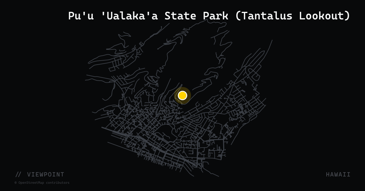
Pu'u 'Ualaka'a State Park (Tantalus Lookout)
Pu'u 'Ualaka'a State Park is the primary scenic overlook on the Tantalus–Round Top Drive loop above Honolulu, accessible via Round Top Drive off Makiki Street. The paved viewpoint atop a 1,048-foot cinder cone offers a sweeping 180-degree panorama of southern O'ahu: Honolulu's skyline, Waikiki, Diamond Head, Manoa Valley, and Pearl Harbor on clear days. The drive itself — a forested, narrow, and continuously curving 7-mile loop — was listed on the National Register of Historic Places in 2009 as the first road on O'ahu to receive that designation. Open daily; no entry fee. Best visited near sunset when Honolulu's south shore is fully lit.
viewpoint · massachusetts
Quabbin Reservoir Winsor Dam Overlook
Winsor Dam impounds the Swift River to form Quabbin Reservoir, Massachusetts's largest body of water at 39 square miles with 181 miles of shoreline. The paved dam top and adjacent visitor center (100 Winsor Dam Rd, Belchertown) provide sweeping views over the open water with no development in sight — the four drowned Swift River towns below the surface give the setting an eerie quality. The Quabbin loop is a well-documented 60-mile motorcycle ride on Routes 32A, 9, 202, and 122.
viewpoint · arkansas
Queen Wilhelmina State Park
Perched at 2,516 feet on Rich Mountain along the Talimena Scenic Drive northwest of Mena, Arkansas, Queen Wilhelmina State Park commands panoramic views of the Ouachita Mountains. The lodge — originally a late-1800s railroad resort named for the Queen of the Netherlands — offers 40 guest rooms and a restaurant, making it the only sit-down meal and lodging stop on the Arkansas section of the 54-mile Talimena National Scenic Byway. The mile-long Lover's Leap Trail accesses a forested ridgeline above the valley.
viewpoint · colorado
Rainbow Curve Overlook
Rainbow Curve Overlook sits at 10,875 feet on Trail Ridge Road (US-34) in Rocky Mountain National Park, 12.8 miles from the Beaver Meadows Entrance. The pullout occupies the outer edge of a wide switchback enclosed by a low stone wall, placing visitors exactly at treeline — sub-alpine forest ends abruptly here, and the tundra begins. Views sweep across Horseshoe Park, the Alluvial Fan, Deer Mountain, the Beaver Ponds, and the full Mummy Range. Accessible vault restrooms and free viewfinders are available in the 30-car parking area. Rainbows appear here regularly after afternoon storms, which are the norm in summer.
viewpoint · colorado
Red Mountain Pass Summit
Red Mountain Pass tops out at 11,018 feet on US-550, the highest point of the Million Dollar Highway between Ouray and Silverton. The namesake rust-red iron-oxide peaks surrounding the summit — Red Mountains #1, #2, and #3 — are the product of hydrothermal alteration from historic silver mining. Scattered roadside pullouts north and south of the summit allow riders to stop among the ochre tailings and collapsed mine structures that spill down the hillside. No guardrails, no shoulder, and thousand-foot drop-offs make this the most photographed — and most discussed — few miles of pavement in Colorado.
viewpoint · montana
Rock Creek Vista Point
One of the first dramatic pull-outs on the Beartooth Highway (US-212) heading south from Red Lodge. A paved interpretive loop at 9,199 ft overlooks the vast Rock Creek Valley and the Absaroka-Beartooth Wilderness — the visual payoff that tells riders they've entered one of America's greatest roads.
viewpoint · arkansas
Rotary Ann Overlook
Rotary Ann Overlook sits on Scenic Highway 7 in Pope County, roughly 25 miles north of Dover and seven miles south of the Newton County line inside the Ozark National Forest. Built in the 1930s by the Rotary Club ladies' auxiliary — making it Arkansas's first highway rest area — the pull-off features rail-guarded platforms that frame sweeping 180-degree views over layered Ozark ridges, interpretive panels, wildflowers, and picnic tables. It remains a shaded mid-ride rest and photo stop.
viewpoint · north carolina
Rough Ridge Overlook
Rough Ridge Overlook sits at Milepost 302.8 on the Blue Ridge Parkway near Linville, NC, at 4,293 feet elevation. A small parking area off the Parkway gives access to a short (1.2-mile round-trip) section of the 13-mile Tanawha Trail. A 1/3-mile hike up reaches a boardwalk across the rocky bald ridge with panoramic views of Grandfather Mountain and the S-curved Linn Cove Viaduct below. On clear days the NC Piedmont towns of Hickory and Lenoir are visible, with Charlotte's skyline faintly on the horizon. The overlook is considered one of the Parkway's premier autumn stops and is a reliable mid-ride stretch break for motorcyclists riding the Blue Ridge Parkway southbound.
viewpoint · oregon
Rowena Crest Viewpoint
Rowena Crest Viewpoint sits at 747 feet atop the basalt bluffs of the Historic Columbia River Highway (US-30) between Mosier and The Dalles, overlooking a broad horseshoe of the Columbia River, Mayer State Park, and the Tom McCall Nature Preserve below. The approach via the Rowena Curves — a series of stacked switchbacks — is itself a landmark motorcycle road referenced widely in touring guides. The paved overlook parking area is managed by Oregon State Parks and sits within Mayer State Park. Views extend west to the Gorge and east toward the high desert.
viewpoint · louisiana
Sabine National Wildlife Refuge
Nearly 125,000-acre coastal marsh refuge on the Creole Nature Trail, home to more than 300 bird species, alligators, and roseate spoonbills. The refuge headquarters sits 8 miles south of Hackberry on LA-27; a 1.5-mile walking marsh trail lets riders stretch their legs amid open water and wildlife directly off the road.
viewpoint · arizona
Salt River Canyon Overlook
The Salt River Canyon Rest Area sits at the bottom of a dramatic 2,000-foot canyon on US-60 between Globe and Show Low, right on the banks of the Salt River. A pair of bridges — the current 1996 vehicle span and the historic 1934 pedestrian bridge — offer a perfect mid-canyon pause. Riders descend hairpin switchbacks through layers of ancient rock before reaching the river level, then climb equally spectacular curves on the far side. Vault toilets and picnic tables are on-site; this is the only developed stop in the canyon itself.
viewpoint · washington
Samish Overlook (Oyster Dome Trailhead)
The Samish Overlook parking area on Blanchard Hill Road in the Blanchard State Forest serves as the primary trailhead for the Oyster Dome summit trail on Chuckanut Mountain. At 1,252 feet elevation the parking area itself offers views across the Skagit Valley, and the 3-mile round trip to Oyster Dome opens a 360-degree panorama taking in Samish Bay, the San Juan Islands, and Mount Baker on clear days. Washington DNR manages the site and asks riders to use this lot rather than the informal Chuckanut Drive roadside pullout. Hang gliders and paragliders launch from the adjacent launch ramp, adding a visual bonus on breezy afternoons.

viewpoint · new mexico
Sandia Crest House
Perched at 10,678 feet at the summit of NM-536, Sandia Crest House sits at the western terminus of the Sandia Crest Scenic Byway after 21 hairpin switchbacks through Cibola National Forest. The facility includes a gift shop, café, and handicap-accessible observation deck with a 360-degree panorama spanning Albuquerque, the Rio Grande valley, and the Jemez Mountains to the west. On a clear day the view stretches over 100 miles. The elevation gain from the base is more than 4,500 feet across 13 miles — one of the most dramatic summit rides in the Southwest.
viewpoint · kansas
Schrumpf Hill Scenic Overlook
An award-winning pull-off on K-177 approximately three miles south of Cottonwood Falls in Chase County. The overlook features paved walkways and interpretive panels describing the flora and fauna of tallgrass prairie — one of the last large intact examples in North America. From the elevated berm, the view sweeps across undulating bluestem grassland with no structures visible in any direction, a panorama that motorcycle travelers on the Flint Hills Scenic Byway consistently cite as a highlight of the corridor.
viewpoint · nebraska
Scotts Bluff National Monument
A 800-foot-tall sandstone and clay bluff rising dramatically above the North Platte River valley — one of the most recognizable landmarks on the Oregon, California, and Mormon Trails. The 1.6-mile Summit Road winds through three tunnels to a paved overlook with sweeping views across western Nebraska into Wyoming. Operated by the National Park Service; established 1919.
viewpoint · west virginia
Seneca Rocks Discovery Center
The USFS Discovery Center sits at the base of Seneca Rocks — the most iconic rock formation in the East. The center offers exhibits on geology and climbing history, a gift shop, and a telescope-equipped deck aimed at climbers on the 900-ft quartzite fin above. A 1.5-mile trail climbs to an observation platform with summit-level views. The junction of US-33, WV-28, and WV-55 right outside is one of the most famous motorcycle crossroads in Appalachia, with gas, food, and lodging all within walking distance.
viewpoint · texas
Skyline Drive Trailhead Overlook
The paved trailhead for the Skyline Drive Trail in Davis Mountains State Park, located at the end of a short spur off Park Road 166, approximately 4 miles west of Fort Davis on TX-118. At 5,503 feet elevation, the overlook provides a broad panorama across the Davis Mountains — the highest range in Texas — with views of Limpia Canyon and the surrounding high-desert basin. The Davis Mountains Scenic Loop (TX-166 and TX-118) is a 75-mile circuit renowned as the best touring loop in West Texas. The trailhead parking area accommodates motorcycles, and the ridge is accessible on foot for wider views.
viewpoint · vermont
Smugglers Notch Summit — VT-108
The high point of Vermont Route 108 through Smugglers Notch is one of the most dramatic mountain-pass experiences in New England. At roughly 1,750 feet the road narrows to a single lane squeezed between towering cliff faces on Mount Mansfield and Spruce Peak, with boulders the size of houses tumbled across the roadside. A small pull-off near the summit allows riders to stop, walk among the glacially deposited rocks, and look up at the sheer walls overhead. The pass connects Stowe to Jeffersonville and is closed to vehicles from late fall through late spring — check VTrans seasonal closure notices before riding. No commercial traffic is permitted; motorcycles, cars, and bicycles only.
viewpoint · west virginia
Spruce Knob Observation Tower
At 4,863 ft Spruce Knob is the highest point in West Virginia and accessible by paved road. The two-story stone observation tower adds additional elevation; the surrounding Whispering Spruce Trail (0.5 mi loop) provides 360-degree views of the Allegheny ridges — on clear days the panorama stretches across multiple states. The approach via Seneca Creek Road (FR-112) adds an unpaved stretch but is passable by street bikes in dry conditions. No fee, open year-round weather permitting.
viewpoint · kansas
Tallgrass Prairie National Preserve
The only national preserve dedicated to the tallgrass prairie, protecting 10,894 acres of the Flint Hills along K-177 north of Strong City. The Spring Hill Ranch limestone mansion (1881) and the Fox Creek Schoolhouse anchor a visitor center where rangers issue free maps and trail guides. A free-roaming bison herd grazes the upland pastures — bison are regularly visible from the ranch loop road. The preserve sits midway on the Flint Hills National Scenic Byway, making it the natural mid-ride stop on the K-177 corridor between Council Grove and Cassoday.
viewpoint · washington
Tipsoo Lake
Tipsoo Lake sits at Chinook Pass on the eastern border of Mount Rainier National Park along SR-410, at roughly 5,000 feet elevation. A subalpine lake set in a glacier-carved basin surrounded by wildflower meadows, it is routinely cited as one of the most photographed landscapes in North America. Mount Rainier fills the western skyline across the water. Parking, picnic tables, benches, and vault toilets are available on site. The Naches Peak Loop Trail and Pacific Crest Trail both start here. SR-410 is typically open from June through October — the same window when wildflowers are at their peak from mid to late July.
viewpoint · new mexico
Valles Caldera National Preserve Overlook
The main gate of Valles Caldera National Preserve at Mile Marker 39.2 on NM-4 opens onto one of the most dramatic roadside views in the Southwest: a 13-mile-wide volcanic caldera floor at 8,900 feet, often dotted with herds of grazing elk. The preserve was formed by a supervolcanic eruption 1.25 million years ago. From the highway, the scale of the open meadow basin against the forested caldera rim is immediately striking. A visitor center with ranger programs and a bookstore sits near the entrance gate. Elk are viewable year-round and the NM-4 corridor through the Jemez Mountains is itself one of New Mexico's premier motorcycle roads.
viewpoint · hawaii
Wailua Valley State Wayside
Wailua Valley State Wayside sits at mile marker 18.9 on the Hana Highway (HI-360), offering one of the finest dual-aspect panoramas on the Road to Hana. From the roadside pull-off, riders can look mauka (inland) into the broad Ke'anae Valley — including the Ko'olau Gap and cascading waterfalls on Haleakala's flanks — and makai (seaward) over the Wailua Village taro fields and the Pacific. The stop requires no entry fee, has restrooms, and is large enough for motorcycles to park clear of traffic. It is the natural mid-point breather on the Run to Hana.
viewpoint · washington
Washington Pass Overlook
A free, paved 0.2-mile accessible path to a panorama of Liberty Bell Mountain and the Early Winters Spires, off the north side of WA-20. Seasonal — the highway closes for snow from late fall to late spring.
viewpoint · north carolina
Waterrock Knob Overlook
Waterrock Knob is the second-highest point accessible by car on the Blue Ridge Parkway, at Milepost 451.2 near Sylva, NC, with the visitor center parking lot at 5,820 feet and the summit at 6,292 feet. The circular parking lot faces both east and west, making it one of the few spots on the Parkway where both sunrise and sunset can be watched from the same location. The seasonal NPS visitor center provides ranger assistance, exhibits on the Eastern Band of the Cherokee, and trail access. On clear days, the Plott Balsam and Great Balsam Mountain Ranges fan out in all directions. The 0.6-mile trail to the summit begins paved and then ascends 400 feet of rocky terrain.
viewpoint · massachusetts
Western Summit Overlook
A paved pull-off on Route 2 just above the Hairpin Turn offering westward panoramic views of North Adams, Williamstown, the Taconic Crest, and Mount Greylock — Massachusetts's highest peak at 3,489 feet. Picnic tables sit at the vista point and the overlook doubles as the trailhead for the Mahican-Mohawk Trail system. Native Americans called this high point Spirit Mountain. Faces west, making it exceptional for sunset riding.
viewpoint · idaho
White Bird Hill Summit Overlook
Sweeping panoramic overlook at 4,245 ft on US-95, marking the divide between the Salmon River and Camas Prairie. The historic White Bird Grade below is a legendary switchback descent — the old road winds 11 miles with 13% grades. Multiple pullouts with interpretive signs explain the 1877 Battle of White Bird Canyon. Views reach deep into the canyon carved by the Salmon River.
viewpoint · nevada
White Domes Day Use Area, Valley of Fire
The White Domes Day Use Area sits at the far end of White Domes Road inside Nevada's oldest and largest state park, Valley of Fire, reached via SR-169 north of Las Vegas. Towering cream-and-red Aztec sandstone formations rise over 150 feet in a tight cluster, surrounded by fire-red Jurassic dunes. The area served as a filming backdrop for films including 'Star Trek Generations' and '3000 Miles to Graceland.' A new $30 million visitor center opened in November 2025 near the park entrance. SR-169 into the park is itself a showcase ride through surreal red geology — the White Domes end-point is the payoff.

viewpoint · new york
Whiteface Veterans Memorial Highway Summit
The Whiteface Veterans Memorial Highway (New York State Route 431) is a five-mile toll road that climbs 2,300 feet to a parking area just 300 feet below the 4,867-foot summit of Whiteface Mountain — the fifth-highest peak in New York State. From the top, on a clear day, riders take in a 360-degree panorama spanning the Adirondack High Peaks, Lake Champlain, Vermont's Green Mountains, and the Montreal skyline. The road gains elevation quickly through open switchbacks and hairpins, making the ascent itself the attraction. A tunnel and elevator connect the parking area to the true summit castle.
viewpoint · georgia
Woody Gap Recreation Area
A National Forest pull-off on GA-60 between Suches and Dahlonega where the Appalachian Trail crosses the highway. Picnic tables and a vault toilet flank both sides of the road, with open views down into the Yahoola Valley. Woody Gap is one of the six named mountain passes on the Six-Gap motorcycle loop and serves as a natural halfway point on the GA-60 run north toward Two Wheels of Suches.
viewpoint · alaska
Worthington Glacier State Recreation Site
113-acre state recreation site at Mile 28.7 of the Richardson Highway, just east of Thompson Pass on the run down to Valdez. A four-mile-long glacier descends nearly to the roadway and is accessible via a paved, wheelchair-accessible trail to a covered viewing platform. Interpretive signs, viewing scopes, parking, and pit toilets on-site. Designated a National Natural Landmark.